Thursday, December 22nd, 2011
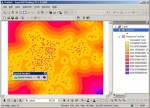
SuperGeo Technologies introduces SuperGIS Spatial Analyst 3, the spatial processing tool working with SuperGIS Desktop 3.1 to complete advanced spatial analyses and tasks. Designed for deriving information from geo-applications, the newly developed SuperGIS Spatial Analyst 3 provides users with various analysis methods such as geographic attributes and geometry relationship.
Wednesday, December 14th, 2011
SuperGeo announces that SuperGIS Online Website is officially launched, making the GIS data and services accessible through the Internet. SuperGIS Online, the SuperGIS spatial data on-demand web services, utilizes SuperGIS Server to develop a GIS environment. Combining the frequently-used maps and GIS functionality, SuperGIS Online provides spatial data in an innovative way. Users can easily
Wednesday, December 14th, 2011
SuperGeo Technologies announced that its reseller in India, RSI SOFTECH, has successfully gotten into the domestic education market. The local partner promotes SuperPad 3 to Adhiyamaan College of Engineering. Adhiyamaan College of Engineering, founded in 1987 and located in the Dharmapuri District of the State of Tamilnadu, purchases SuperPad 3, the full function mobile GIS software
Thursday, December 8th, 2011
SuperGeo Technologies, the leading global provider of complete GIS software and solutions, is pleased to announce that the University of Sharjah in United Arab Emirate (UAE) utilized SuperGIS Desktop 3 for the research and teaching of geospatial information. Founded in 1997, The University of Sharjah is a semi-governmental higher educational institute in the Emirate of Sharjah,
Thursday, December 8th, 2011
SuperGIS Server, developed by SuperGeo, has been successfully applied to “Yilan Pollution Control GIS.” To effectively manage and control the pollution data and distribution in Yilan, Department of Environmental Protection Yilan adopts SuperGIS Server to build “Yilan Pollution Control GIS.” The website collects the related layer data for the staff and provides spatial data display, such
Tuesday, November 29th, 2011
SuperWebGIS, developed by SuperGeo Technologies, has been successfully implemented in “Miaoli Health Resource Web”. To provide with a map service web for citizens to query public health information, the Public Health Bureau of Miaoli County Government adopts SuperWebGIS to establish the “Miaoli Health Resource Web.” The web mainly provides three types of information: public health information
Tuesday, November 29th, 2011
SuperGeo Technologie today announced a new sales achievement in Brazil, where GEOTOPO procured SuperGIS Desktop 3 to assist the topographic and geospatial project services. Located in Brazil, GEOTOPO is a local company specializing in topography, surveying, geodesy, and imagery analysis. The covering services are various, such as thematic cartography, geodatabase creation, imagery processing, urban planning, land
Tuesday, November 22nd, 2011
SuperGIS Mobile Tour 3.0 (for Android), the mobile tour system developed by SuperGeo, has been successfully applied in the Industry-Academy cooperation hosted by the Great Roots Forestry SPA Resort and Chihlee Institute of Technology as the guide service application.
Tuesday, November 22nd, 2011
SuperGeo Technologies shared that NAVAIDS, a GPS and survey company based in Perth, Australia, selected SuperPad 3– the fully-functional mobile GIS software, for the professional project services. The procurement is contributed by Cody Corp., SuperGeo’s distributor in Australia.
Wednesday, November 2nd, 2011
SuperGeo Technologies announced that Municipality of Recanati in Italy purchased SuperGIS Desktop 3 to assist in the service planning and development of land and buildings. The procurement is contributed by Helix S.r.l., the exclusive distributor of SuperGeo in Italy.