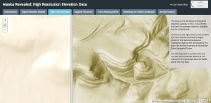
The map on the left shows the existing full-coverage data collection available for the United States. The map on the right shows the new data developed by NGA, NSF and PGC. (Credit: Esri)
The National Geospatial-Intelligence Agency (NGA) and the National Science Foundation (NSF) released new 3-D topographic maps of Alaska on Sept. 1, 2016, in support of a White House Arctic initiative to inform better decision-making in the area.
The 3-D digital elevation models (DEMs) are the first to come from the ArcticDEM project, which was created after a January 2015 executive order calling for enhanced coordination of national efforts in the Arctic.
The DEMs are based on two-meter-resolution images captured by DigitalGlobe commercial satellites. Models of the entire Arctic are scheduled for release in 2017.
“The models will play an important role in informing policy and national security decisions,” said Robert Cardillo, NGA director. “They may also provide critical data and context for decisions related to climate resilience, land management, sustainable development, safe recreation and scientific research.”
The project brings together a unique set of national assets, including the White House Office of Science and Technology Policy, NGA, NSF, the Polar Geospatial Center (PGC) at the University of Minnesota, University of Illinois, Ohio State University, and Cornell University.