Sensors and Systems
-->
Breaking News
Expedition Sets Sail to Explore Active Underwater Volcanoes and Deep Sea with Advanced Technology 
Rating12345On May 7, 2025, the Ocean Exploration Trust exploration...
Woolpert Acquires Bluesky International, UK’s Largest Commercial Aerial Survey Firm
Rating12345The acquisition adds over 100 survey and mapping professionals...
Teledyne Geospatial to Participate in SeaSEC Challenge Weeks in the Netherlands
Rating12345Vaughan, Ontario, CANADA – May 13, 2025 — Teledyne Geospatial...
  • Rating12345

The effects of Typhoon Haiyan, which hit the Philippines on November 8 2013, were photographed on 13 November 2013 by a Pléiades satellite, which had captured images of the same zone (Tacloban) on 7 March 2013.

Astrium builds and operates the Pléiades high-resolution satellites that are providing such images within the framework of the International Charter on Space and Disasters. These images are being made available to rescue teams and authorities.
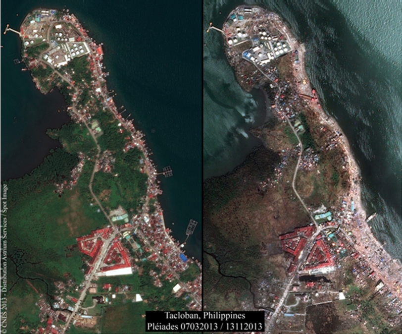
Astrium Tecloban

These high-resolution images can be downloaded here: ftp://ftp.astrium-geo.com/Philippines/