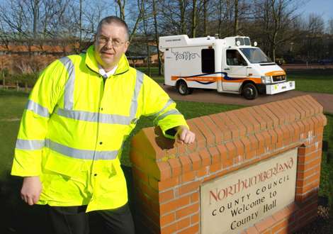
PR – Highway surveying specialist Yotta DCL has been awarded a contract worth GBP 54,000 from Northumberland County Council to survey the road surface condition of its 1890km road network. Using its innovative ARAN (Automatic Road Analyzer) scanning vehicle, Yotta DCL will provide Northumberland with accurate data to enable the Council to develop a consistent approach to highway maintenance across its network and to accurately target schemes. The SCANNER (Surface Condition Assessment for the National Network of Roads) surveys will be undertaken on A, B, and C-class roads.

“The survey information will enable us to reliably model deterioration and depreciation of the network. We use a Red, Amber, Green approach to illustrate road conditions on area maps for the entire network.
This gives an instant visual reference to what needs immediate attention and also helps explain any backlog of outstanding works. Using SCANNER data in this way has helped us to better prioritise schemes and demonstrate that we are consistent in our approach,” says Dale Rumney, Pavement Manager, Community & Environmental Services, Northumberland County Council.
“We will also be able to demonstrate that we are making improvements as the data helps us to show accurate before and after reports on schemes, which gives positive proof that we are making progress,” he continues. Yotta DCL will perform the SCANNER surveys using its latest ARAN vehicle. The vehicle is equipped with an advanced surface laser scanner that captures surface data together with its precise location. This data includes defects such as wheelpath rutting, edge deterioration and cracks as well as the road geometry and longitudinal profile. Once processed, Northumberland loads the data into its pavement management system for analysis. “Yotta DCL turned in the most competitive tender for the SCANNER surveys. They are a fully accredited contractor and we find the team very easy to work with. We developed the network details and information specifications and simply handed these over to the survey team and they have proven to be very helpful,” says Dale Rumney.