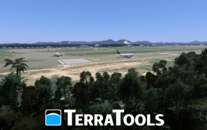
TerraSim is pleased to announce our latest release of TerraTools terrain generation software (version 5.9.1), which now includes support for importing terrain changes from VBS4’s VBS Geo mode and also a CDB Export capability to complement the existing CDB import capability.
Additionally, TerraSim is launching a short-form one day TerraTools training course and a temporary six-month price promotion on TerraTools Core (TT Core) and TerraTools Gov (TT Gov) bundles.

VBS4’s VBS Geo mode is a powerful and easy-to-use 3D terrain editor that anyone can use and now TerraTools can easily import those changes. This capability gives TerraTools and VBS4 users a brand new workflow that combines the simple 3D terrain editing in VBS Geo and the sophisticated control and large-area production offered by TerraTools. The combined workflow is unique to TerraTools and makes TerraTools the best choice for building complex and/or large VBS4 terrains. This importer is a free upgrade to users with active TT VBS or TT Max maintenance.
The new Export CDB plug-in for TerraTools allows users to produce correlated terrain exports for CDB-compliant simulators. TerraTools already has a CDB importer so it is now an even more capable terrain editing tool for the popular CDB format and facilitates easy correlation of CDB with other formats already supported by TerraTools such as VBS3, VBS4, OpenFlight, and OneSAF, and many more. This exporter is a free upgrade to users under active TT Core, TT Gov (was TT Pro), or TT Max maintenance. It is an optional plug-in for users who have the TT VBS bundle.
The one-day, short-form training course will introduce users to TerraTools and show how to build and manage a complete terrain project from start to finish.
Finally, for six months only (ending on 17 September), TerraSim is offering a significant price promotion on two of our TT bundles.
TT Core license price will drop to $14,500, a 31% price reduction. The TT Core bundle offers a standard set of importers and exporters for common simulation formats including OpenFlight, CDB, plus Unity and Unreal via FBX.
TT Gov license price will drop to $29,000, a 10% price decrease. The TT Gov bundle, renamed from TerraTools Pro, is designed for government agencies and their contractors to build high-fidelity virtual environments for common runtimes used by government and defense organizations. In addition to enabling import from all the formats that the TT Core Bundle offers, the TT Gov Bundle enables users to export to the following runtimes: OpenFlight, CDB, CTDB, JSAF, SEDRIS, OneSAF and WARSIM OTF, VR Forces, and Unreal/Unity via FBX.
Find out more about the TerraTools Bundle options.
Contact [email protected] to find out more about the TerraTools bundles.
TerraTools is the military simulation and training industry’s leading virtual terrain generation software. With world class features heavily rooted in automated processing, TerraTools rapidly produces high-fidelity, correlated geo-specific environments for use across visual, constructive, and serious game runtime applications. Advantages of TerraTools include:
TerraSim, a Bohemia Interactive Simulations company, is a leading technology company that specializes in the development of advanced software solutions to automate geospatial source data preparation and terrain generation. Our products are designed to be flexible, scalable, and compatible by continuing to support the widest range of visual, constructive, and serious game runtimes in the military simulation and training industry.