Sensors and Systems
Breaking News
Terra Drone Invests in Aloft Technologies to Enter U.S. Market, Boost Global UTM Development
Terra Drone Corporation, a leading drone and Advanced Air...
LeddarTech Concludes Licensing Arrangement With Renesas
QUEBEC CITY, Canada — LeddarTech Holdings Inc. (“LeddarTech”) (Nasdaq: LDTC),...
Hexagon partners with Nemetschek Group
(Stockholm, Munich, 26 March 2024) Hexagon’s Geosystems division and...

flooding

image

Monday, November 14th, 2016

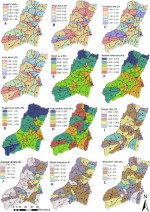
Geospatial Science Identifies High-Risk Flooding Areas in Egypt

Researchers from UT Dallas and other universities developed geospatial science methods to help the Egyptian government determine how to avoid flooding in a coastal mountain region. The government wants to develop the area for tourism, but flash flooding and associated hazards have hampered efforts, according to Dr. May Yuan, Ashbel Smith professor of GIS. “We