Wednesday, June 15th, 2016
Leicestershire, UK, 15 June 2016 – English local authority South Tyneside Council is using the latest digital aerial survey data from Bluesky to update essential Council records and inform decision making. By comparing the new photography with previous imagery, officers are even able to identify potential breaches of planning permission and land encroachment. Flown in 2015
Tuesday, June 14th, 2016
PITTSBURGH, PA – Michael Baker International, a global leader in engineering, planning and consulting services, today announced a partnership with the Orleans Parish Communication District (OPCD) and Louisiana Geographic Information Center (LAGIC) to supply the Michael Baker International DataMark™ DX geospatial data software to support the GIS data component of the existing 9-1-1 operations and
Monday, June 6th, 2016
An array of Earth observation satellites, including the Sentinels involved in Europe’s Copernicus programme, collect untold amounts of data as they circle our planet. This high-resolution imagery and further information on climates and environments present tremendous potential in overcoming some of the biggest challenges of our time. Thanks to new developments in big data, cloud

Monday, March 28th, 2016
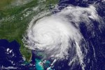
The launch of the GOES-R geostationary satellite in October 2016 could herald a new era for predicting hurricanes, according to Penn State researchers. The wealth of information from this new satellite, at time and space scales not previously possible, combined with advanced statistical hurricane prediction models, could enable more accurate predictions in the future. “For
Thursday, November 19th, 2015
ALBUQUERQUE, N.M., November 19, 2015 — After a disaster or national tragedy, bits of information often are found afterward among vast amounts of available data that might have mitigated or even prevented what happened, had they been recognized ahead of time.
Tuesday, October 27th, 2015
October 27, 2015 — Integrating different sources of open data often generates great value and new information. For example, by integrating earthquake and tsunami locations with a coastal city vulnerability index, you will be able to find which cities are most vulnerable to tsunamis. Generally, data itself may not contain any information, but contrarily information
Wednesday, October 7th, 2015
Abu Dhabi, October 7, 2015 — At the second Eye on Earth Summit in Abu Dhabi today, experts highlighted the achievements of the movement’s Special Initiatives in providing data, tools and frameworks to help inform decision-making for sustainable development. The Special Initiatives are the engine and driving force behind Eye on Earth and a key
Friday, September 25th, 2015
DENVER, Sept. 25, 2015 — Intermap Technologies (TSX:IMP), (ITMSF:BB), a leading provider of location-based solutions, today announced that it has entered into an agreement with Atkins, one of the world’s most respected design, engineering, and project management consultancies, to include their natural catastrophe risk and hazard data archives, including North American earthquake data, in its InsitePro
Friday, August 21st, 2015
Logan, UT, August 21, 2015 — Rugged handheld computer manufacturer, Juniper Systems, is seeing a change in leadership as its current President and CEO, Rob Campbell, is stepping aside after fourteen years at the company’s head, to accept a position as President of Campbell Scientific, Inc., Juniper Systems’ parent company and a world leader in precision
Thursday, August 13th, 2015
Austin, TX, August 13, 2015 — HUVRData, LLC, the drone-based data analytics company, today officially launched and announced $2 million funding from angel investment organizations including Central Texas Angel Network (CTAN), Houston Angel Network (HAN) and the Texas HALO Fund. In the past 1.5 years, HUVR has built out its technology, secured the full FAA approval for