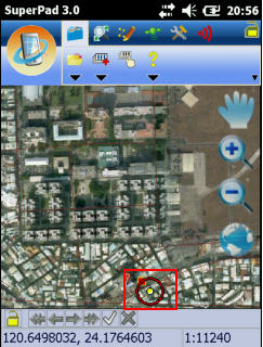
SuperGeo Technologies today announced that its latest fully functional mobile GIS software, SuperPad 3.0a, is officially launched to global market. SuperPad 3 consists of comprehensive and complete GIS functions, which integrates mapping, GIS, and GPS functions with hand-held devices and assists field surveyors in collecting, editing, and measuring spatial data in an easy and effective way. Besides in addition to enhancing the original functions, the latest version of SuperPad 3 also improves the integration with SuperGIS Server 3, supports creating Graphics Layer, Laser Rangefinder extension, and reading Cached Map.
1. Integration with SuperGIS Server 3: SuperPad 3.0a supports to edit the map distributed by SuperGIS Server 3, which allows multi-users to read, add, edit features and attribute data, and synchronize map data. It helps users manage the files effectively and avoid losing data from overwriting the files.  2. Creating Graphics Layer: On Graphics Layer, users can add various kinds of graphics at the same layer, including point, polyline, polygon graphics, and texts so that users can rapidly record the information.
3. Laser Rangefinder Extension: SuperPad 3.0a supports to work with LaserCraft Contour XLR and TruPulse360/360B to measure in the field. Users can use GPS position as datum or use reference point as datum to get the centroid information, such as Slope Distance, Horizontal Distance, Vertical Distance, etc.
4. Reading Cached Map: SuperPad 3.0a supports to read the Cached Map (*.sgt) generated by SuperGIS Map Tile Tool to greatly improve the map performance. SGT file is not editable but contains spatial information. In that case, the map performance on mobile device will not be influenced while reading large quantities of vector layers.
Moreover, SuperPad 3.0a can work with SuperGIS Desktop 3 and SuperGIS Server 3 to complete the effective GIS workflow and improve the work efficiency. About the details and the free trial of SuperPad 3.0a, please visit our website www.supergeotek.com.
As to the list of bug fixed in the latest version, please refer to SuperGeo GIS Forum http://www.supergeotek.com/Forum/default.aspx?g=forum.