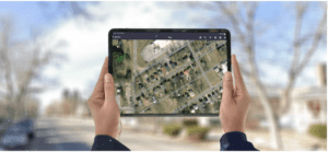
Mobile GIS redlining capability takes field service management software to a new level
(Boston, USA) – OverIT, a leading provider of Field Service Management (FSM) software solutions, has added mobile redlining GIS capability to its industry leading platform to enable field technicians to work more quickly, accurately, and safely.
According to Daniel Goldstein, SVP of Product Management, mobile GIS redlining capability is the latest step forward on the road to transforming the way field technicians work.

“Our solutions are designed based on the understanding that accurate and immediate communication is vital to operations,” Goldstein says, “and we have concentrated our efforts for the last two decades on introducing innovations and improvements that enable better informed decision-making in the field. The newly added GIS capability enhances our platform, empowering streamlined operations, expediting field data collection, and improving collaboration.”
Field conditions are dynamic, but changes are not always incorporated into the maps field crews rely on to navigate operations on the ground. OverIT’s new mobile GIS redlining capability allows technicians to seamlessly capture real-time observations, make annotations, and mark updates and corrections directly on a map on a handheld device. Changes are sent to the back office to review and make the updates in the GIS data.
Instead of relying on paper records and complicated processes to make critical updates, field workers can make real-time edits and ensure that the updates are shared across all stakeholders. The ability to reconcile outdated maps with actual conditions on the ground delivers concrete benefits, eliminating confusion, improving operational safety, and reducing inefficiencies.
The OverIT platform is the key, providing field technicians with a simple interface on a “single pane of glass” that allows them to navigate layers of data on one screen and execute all their work in one powerful application.
“We are continuously enhancing communication and precision in the field, bridging the gap between the digital and physical worlds for more efficient operations,” Goldstein says.
About OverIT
OverIT is a leading FSM solutions provider with over 20 years of expertise, solving complex field service in enterprise businesses globally. Over 300 clients are increasing daily efficiencies in linear asset management, with over 100,000s of field workers being dispatched daily, and leveraging field collaboration in their mission-critical operations.
Our cutting-edge technology and our ability to deliver at scale is backed by Bain Capital and NB Renaissance. OverIT is recognized by premier global advisory and consulting organizations as a leading FSM and Field Collaboration vendor.