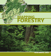
 Forest managers and others working and operating in forests have long depended upon the use and application of GIS. This technology has enabled them to establish forest inventory information upon which they have been able to integrate landscape change over time and to initiate operations. Mapping Forestry provides a glimpse into the ways forestry related mapping is applied around the globe and across different disciplines.
Review by Jeff Thurston
Forest managers and others working and operating in forests have long depended upon the use and application of GIS. This technology has enabled them to establish forest inventory information upon which they have been able to integrate landscape change over time and to initiate operations. Mapping Forestry provides a glimpse into the ways forestry related mapping is applied around the globe and across different disciplines.
Peter Eredics manages ESRI’s business development and marketing in the forest products industry, accordingly he is continually in touch with the global forest industry and the many users who are exploring and applying GIS in this sector. He draws upon a wide diversity of users, and has assigned different chapters to the primary forestry related activities. Chapters include mapping for business, inventory, operations and sustainability.
The book begins with the Para Calha Notte region of Brazil. These forests initiated plans in 2006 for the purposes of protecting the forests and establishing biodiversity management scenarios. This work involved mapping and the calculation of forest fibre transportation costs as a basis for determining cost-benefit analysis. This effort also supported the delineation of illegal harvest locations and estimations.
Other forest land inventory work was begun in the United States where Forest Inventory and Analysis (FIA) supports investigations into fibre flow. It was found that many people do not understand how forests ‘work’ in terms of production, conservation and preservation and this work enabled a better undertsanding of these functions. The book contains a unique map in the inter-state relationships of imports and exports of products – using map techniques that compare similarly to subway mapping.
The City of Florence, Alabama employs a program called STRATUM that is used to provide a forest inventory of the cities trees. The age, diameter, height and other information for individual trees is placed into the program. This allows the city managers to see, through the use of maps, the current state forests within the city. By comparison, forest managers in Romania are using GIS technology to manage the country’s forests. The technology allows them to determine where thinning and harvest operations can be conducted in a timely manner as well as providing a means to administer forests between districts.
Researchers from Kyushu University have established research areas in north Cambodia to investigate forest structure. This work includes the use of global positioning tools (GPS) that supports helps them to locate the sample areas where soil types, elevation, forest trees and other field-based data is collected. The book includes other examples for places in British Columbia, Canada, Bolivia, United States and Finland.
Users will find each individual case also includes a ‘recipe for map-building success’ that describes the primary map steps for creating the case solution. This will assist those interested in creating forest related maps in their own work. In practice these follow similar work flows that one might establish through using the Model Builder in the software.
Mapping Forestry is a general summary and overview for those interested in using GIS mapping tools in related forest activities. It helps to describe to the uninitiated how GIS is being applied to forest related problems around the world across a range of activities. Accordingly the book serves as a good resource source based upon real world examples where GIS has been applied for forestry mapping applications. It will support users with ideas as to how they might develop different types of maps for landscape level natural ecosystems.
———————————————————————–
Jeff Thurston is co-founder and co-editor of V1 Magazine / Asian Surveying and Mapping for Vector1 Media. He is based in Berlin, Germany.