Sensors and Systems
Breaking News
ICEYE and Esri Australia (through Boustead Geospatial) partner to deliver unprecedented hazard intelligence across Australia and Southeast Asia
Rating12345Partnership brings real-time hazard intelligence to emergency responders, utility and...
ESA and GEOSAT Join Forces to Accelerate Space Entrepreneurship and Sustainable Innovation
Rating12345 The European Space Agency (ESA) has signed a...
ABAX Launches ABAX Site Operations – Redefining the Real-Time Location System (RTLS) Market
Rating12345 ABAX, one of Europe’s providers of connected mobility...
  • Rating12345

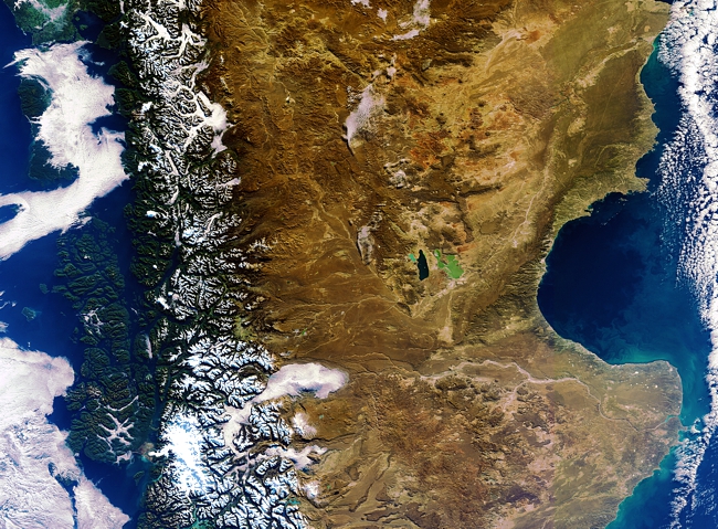
This Envisat image is dominated by southern Argentina, with the mountainous terrain of the Andes in Chile to the west (left). The lush, snow-capped mountains slope into the arid inland areas of Argentina’s Chubut province and neighbouring Santa Cruz province to its south – home to a series of plateaus and depressions.

In the centre, two lakes in Argentina’s Chubut province are visible. Lake Musters’ depth of about 20 m gives it a dark hue, while Lake Colhué Huapi fills a shallow depression, about 2 m deep. 

Chile_ArgentinaSanQuintinMER_FR_20110603_48415