Thursday, July 14th, 2011
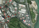
Bluesky Solar Maps are helping businesses in the South of England benefit from free or low cost electricity. Working with Tidebank Energy, Bluesky has identified commercial properties across Hampshire, Dorset and West Sussex that have suitable roofs for arrays of solar panels. Qualifying businesses can enjoy free Solar electricity in exchange for renting their roof
Wednesday, July 13th, 2011
Microsoft Corp. has entered into a licensing agreement with GeoVector Corporation, the world leader in Augmented Reality and pointing-based local search solutions for mobile devices. The non-exclusive multi-year agreement gives Microsoft rights to use concepts covered by GeoVector’s patents. “We are thrilled to have Microsoft join the growing number of GeoVector licensees,” said John Ellenby, GeoVector’s
Wednesday, July 13th, 2011
IBM today announced the IBM Intelligent Operations Center for Smarter Cities, a new solution designed to help cities of all sizes gain a holistic view of information across city departments and agencies. By infusing analytical insights into municipal operations through one central point of command, cities will be able to better anticipate problems, respond to
Wednesday, July 13th, 2011
Trimble announced today a four-tiered precision agriculture product training and support initiative for Trimble Agriculture’s resellers and grower customers.
Wednesday, July 13th, 2011
StreetMapper, the vehicle-based laser mapping system, is now being offered with a range of tools for the automatic calculation of bridge heights and other measurements. Designed to simplify the complex task of processing the billions of individual laser scanned measurements recorded by the world’s most accurate mobile mapping system StreetMapper Bridges is ideally suited for
Wednesday, July 13th, 2011
earthmine, inc. today announced the immediate availability of the earthmine Widget for the ArcGIS Viewer for Flex, providing a simple way for earthmine and ArcGIS users to publish their geospatial data and earthmine 3D street level imagery to the web. The earthmine Widget is built with earthmine’s Software Development Kit (SDK) for Flash and delivers
Tuesday, July 12th, 2011
SuperGeo Technologies, the leading global provider of complete GIS software and solutions, is pleased to announce that SuperGIS Mobile Tour 3.0 (Android version) is utilized to develop a whole new navigation system for Yehliu Geopark. As a famous resort with unique geological landscapes in North-eastern Taiwan, Yehliu Geopark has launched an electronic navigation system for the
Monday, July 11th, 2011
Zebra Imaging announced today that the company is launching a software add- in that will allow Esri users to print their 3D data in a holographic display for true 3D presentations and analysis. Zebra Imaging has created over 10,000 3D maps of areas of interest for the U.S.
Monday, July 11th, 2011
GeoEye, Inc. is launching GeoEye Image Pack for Esri ELA Customers on July 11, 2011, with its partner, Esri®. Small governments, public safety organizations and utilities rely on Geographic Information Systems (GIS) and imagery to effectively perform regular activities within tight budgets, such as urban planning, economic development and public works. The GeoEye Image Pack
Monday, July 11th, 2011
NAVTEQ, the leading global provider of maps, traffic and location data enabling navigation, location-based services and mobile advertising around the world, is announcing at the 2011 Esri International User Conference that the NAVTEQ map is now available in Esri’s File Geodatabase format. A Geodatabase is the native spatial data storage and management framework for Esri’s
