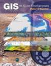
 Students and teachers are constantly searching for new and useful geographical information system (GIS) educational materials. While many GIS concepts are universal and apply around the world, instructional material that contains localised content is in greater demand – people learn more quickly and identify with educational material they are familiar with. GIS for A-level Geography is written to not only provide basic GIS concepts, but it also includes a series of applications built around data originating from the British Isles.
GIS for A-level Geography
by
Peter O’Conner
The Geographic Association
224 pages; 2008 – ISBN-978-1-84377-210=1
Review by Jeff Thurston
Many new students and teachers become associated with GIS yearly. They are often in search of new and exciting material that can help them to learn about geography, spatial issues and some of the problems in their communities and around the world that demand improved spatial thinking. This is a tall task and educational materials need to be updated while preserving basic conceptual knowledge. At the same time, many teachers have found that conceptual knowledge is only one part of the learning equation.
Students (and teachers) also need to understand the tools and technologies used for studying spatial data and issues.As a result, books that include examples and applications which incorporate practical lessons and participation can stimulatestudent learning more quickly and effectively.
Peter O’Connor has written GIS for A-level Geography with the support of The Geographic Association, ESRI(UK) and NAVTEQ, all providing goods and services in the United Kingdom. This book does not beat around the bush, it gets straight to the point on GIS education for A -level students. It is divided into two parts, the first entitled GIS theory and applications and the second half of the book providing practical examples. ESRI ArcGIS 9.2 software is used for the examples. Two CD’s are included with the book, one with data and the other including digital print material. A trial version of the software is also provided on one of the disks.
In Unit 1 – Topic A provides an introduction to GIS describing the importance of information. The relationship of quality information to effective decision making is made early on. Technologies such as global positioning systems (GPS), remote sensing (RS) and surveying are spoken about so that students can gain an understanding as to modern technologies and their contribution toward GIS.
The book asks and answers the question “what makes data spatial or geographical?” As the readers moves through the first pages, high quality and colorful graphics help to keep interest flowing. I found myself caught in the graphics as I read along, the images supporting the text well and text legible.
Community mapping is discussed and topics like topology, real-wrold modeling, vector and raster data structures, projection and coordinate systems are presented. The book also provides a good discussion on how GPS data can be collected and used in addition to the collection of data from satellite imagery. It moves along at a quick pace, avoiding deep discussions and providing the basics that A-level students would need to know and probably feel comfortable with. Spatial query, statistical operators and classification are presented and clearly discussed to enable students to grasp concepts quickly and easily. These are followed by interpolation and overlay analysis.
The conceptual information is supported with examples of GIS applications from the following organisations:
Unit 2 – practical exercises are designed to help students familiarise their knowledge while working with the GIS software. The examples ask questions such as, “where are all the people?” and “How do patterns of crime vary across England and Wales?” Several images are screen shots of the software in operation.
This is one of the better books I have seen for use by A-level students. It doesn’t intend to provide in-depth knowledge on GIS topics, but it sticks to the goal to provide beginning students and teachers with a very strong overview of what a GIS is and does – and can do. What really makes this book work are the graphics. It is loaded with them, constantly steering-the-eye-to-think and they support the flow very well. I’m not sure that one would want to include more material into a beginner book on the topic of GIS for students at this level. The book is full of British content. But I think teachers anywhere will immediately find this a useful resource. I wish I had this book when I was starting out.
Jeff Thurston is Co-founder Vector1 Media and editor, Europe, Middle East, Africa and Russia for V1 Magazine.