Wednesday, October 12th, 2016
MELBOURNE, Australia – ITS World Congress – TomTom (TOM2) today announces a joint autonomous driving demonstration with Bosch. TomTom provided its HD Map and RoadDNA technology to setup a demonstration on the Australian F1 Grand Prix circuit at Albert Park; these novel products are important components to enable Bosch’s demo vehicle to perform in autonomous
Wednesday, October 12th, 2016
DJI and Datumate have begun offering a drone, software and app package that fully automates and expedites site surveys. Tailored for professional surveying jobs, the DJI-Datumate Site Survey Solution simplifies the surveying and mapping processes, while maintaining superior accuracy. Shenzhen-based DJI is the world’s top aerial-imaging company. Israel based Datumate is a leader in automated
Wednesday, October 12th, 2016
Teledyne Optech is pleased to announce a high-performance scanner update to its innovative line of airborne laser terrain mappers, the Optech Galaxy ALTM™. The Galaxy’s scan efficiency has been engineered to deliver an additional 30% boost to its class-leading area coverage rates. When coupled with its innovative SwathTRAK™ and PulseTRAK™ technologies, collection efficiencies exceeding 70%
Wednesday, October 12th, 2016
AltiGator and YellowScan are pleased to announce an ultra-light weight LiDAR UAV combo allowing for the first time centimetric UAV surveys in urban areas, in accordance with most regulations. The YellowScan Surveyor ultra-light stand-alone LiDAR system is embedded on the OnyxStar® XENA multirotor UAV, which is the last generation professional drone designed by Altigator. Compact,
Wednesday, October 12th, 2016
Drone mapping software developer Pix4D launches hybrid solutions today that integrate mobile, desktop, and cloud platforms for more flexible mapping. “When we started Pix4D six years ago, we were a cloud processing company,” said Christoph Strecha, Pix4D’s CEO. “But our first clients were photogrammetrists, land surveyors, or working in mining, and needed desktop software
Wednesday, October 12th, 2016
SEATTLE, Wash. — LizardTech®, the creator of MrSID® and provider of software solutions for managing and distributing geospatial content, today announced the release of GeoExpress® 9.5.3. The company’s flagship image asset handling product to compress, manage, distribute, integrate and deploy geospatial images and LiDAR point clouds as high-quality MrSID files now has expanded format support

Tuesday, October 11th, 2016
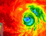
As Hurricane Matthew developed into a Category 4 hurricane that pummeled the Caribbean and southeastern United States, killing more than 1,000 people, disrupting electricity and other utilities to hundreds of thousands, and causing billions of dollars in economic damage, many of the world’s satellites and sensors were tuned to the storm, and recorded its path
Tuesday, October 11th, 2016
Montreal, Canada, October 11th, 2016 – SimActive Inc., a world-leading developer of photogrammetry software, is pleased to announce a new subscription-based offering for Correlator3D™ UAV. The rental option allows users with a dynamic workload to access a high-end product at minimal cost. “Correlator3D™ UAV was developed for leading mapping firms, military and government organizations,
Monday, October 10th, 2016
WESTMINSTER, Colo. – DigitalGlobe, Inc. (NYSE: DGI), the global leader in earth imagery and information about our changing planet, today announced the WorldView-4 satellite launch has been delayed due to ongoing efforts to restore and test infrastructure at Vandenberg Air Force Base following last month’s wildfires. DigitalGlobe is working closely with the U.S. Air Force
Monday, October 10th, 2016
SUNNYVALE, Calif., Oct. 10, 2016 —Trimble (NASDAQ: TRMB) announced today that Delair-Tech has acquired its Belgium-based Gatewing Unmanned Aircraft System (UAS) engineering and manufacturing business. Delair-Tech is a leading provider of long-range, fixed-wing UAS solutions for industrial inspection and asset management applications headquartered in Toulouse, France. Delair-Tech intends to grow the acquired business as part