Monday, March 26th, 2012
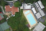
For the first time Singaporean authorities have given permission for a photogrammetric UAV mapping/modeling flight over an important area of the city. In the context of the SEC-FCL (Future Cities Laboratory) project a pilot study is conducted with the goal to generate a high quality 3D city model of the NUS campus from UAV images.