Wednesday, March 19th, 2014
Trimble introduced today a new premium map layer that adds private land ownership, Assessor’s Parcel Number (APN) and parcel boundaries on topographic and satellite maps from MyTopo. The layer option is available via MyTopo’s popular print-on-demand Website mytopo.com . Private land ownership maps are used by professionals involved in real estate, land use planning, agriculture
Tuesday, March 11th, 2014
Trimble (NASDAQ: TRMB) introduced today the InSphere platform for geospatial information management. An innovative approach for central management of geospatial operations, Trimble InSphere improves workflow, maximizes efficiency and transforms the way geospatial professionals work and access critical operational information.
Wednesday, February 19th, 2014
Trimble (NASDAQ: TRMB) announced two new additions to its airborne LiDAR portfolio. The Trimble® AX60i and AX80 are highly capable, versatile systems that meet the demands of aerial survey operators for corridor and wide area mapping projects. The new airborne systems, together with flight planning and analysis software tools, have been designed to provide rapid
Tuesday, January 21st, 2014
Trimble (NASDAQ: TRMB) announced today the addition of its Trimble® UX5 unmanned aircraft system (UAS) to its Agriculture product portfolio for aerial imaging and mapping. The Trimble UX5 system can enable Ag service providers to easily capture aerial images for scouting and monitoring crop health such as detecting pests, weeds and nitrogen deficiencies. The system can
Thursday, December 12th, 2013
Trimble announced today that it has acquired the assets of privately-held C3 of Madison, Wis. The acquisition will enable Trimble to provide unique soil information as well as decision recommendations to farmers’ trusted advisors—such as agronomists, Trimble resellers or Ag retail suppliers. Farmers will be able to view the C3 data and recommendations from their

Tuesday, November 5th, 2013
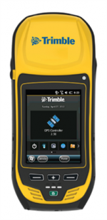
Trimble introduced today the next generation of its Trimble GeoExplorer data collection solution. The new Geo 7X includes an integrated laser rangefinder module, extended GNSS capabilities and improved hardware performance. Together with robust field and office software, the new Trimble Geo 7X handheld can enhance productivity in difficult physical conditions and challenging GNSS environments.
Wednesday, October 9th, 2013
Trimble introduced today the latest version of its deformation monitoring software–Trimble 4D Control version 4.2. The new version of the monitoring software delivers enhanced communications with the Trimble NetR9 and new NetR9 Ti-M GNSS receiver, REF TEK seismic sensors and the Trimble S8 total station. It also supports geotechnical sensors, weather stations, level data and
Tuesday, October 8th, 2013
Trimble announced today new additions to its aerial imaging portfolio –the Trimble AX60, a new airborne LIDAR system; and an updated version of its Inpho processing software. The announcement was made today at INTERGEO 2013, the world’s largest conference on geodesy, geoinformatics and land management.
Wednesday, September 18th, 2013
Trimble (NASDAQ: TRMB) announced today a Preview version of its CenterPoint™ RTX™ post-processing service, enabling GNSS observations using available Galileo and BeiDou Middle Earth Orbit (MEO) satellites. Powered by Trimble® RTX technology, the free CenterPoint RTX post-processing service provides better than centimeter level positions.
Wednesday, September 18th, 2013
Trimble introduced today a new version of its eCognition geospatial analysis software that enables images, point clouds and vectors to be integrated and analyzed to quantify features or detect change. eCognition version 8.9 offers new functions for automated information extraction from geospatial data collected with mobile mapping solutions. This allows geospatial service providers and transportation