Sensors and Systems
Breaking News
Decoding Earth’s Fingerprint: Advanced Navigation and NILEQ Collaborate on Breakthrough Resilient Navigation Technology
Rating12345Global, November 2024 – Advanced Navigation, a world leader...
Woolpert Welcomes Global Head of Technology and Innovation Amar Nayegandhi
Rating12345The respected ASPRS Fellow, photogrammetrist, and remote sensing scientist...
Geo Week Announces Keynote – Dallas Fort Worth Airport’s Digital Evolution
Rating12345Expert panelists discuss how the use of geospatial technology...
  • Rating12345

Pleaides the very high resolution satellite manufactured and operated by Astrium, photographed the new island of Zalzala Koh from its orbit 695km above the Earth on 26 September 2013.

Using the satellite image, the geo-information experts from Astrium Services have determined the dimensions of the new island 175.7 metres by 160.9 metres – giving a total surface area of 22,726m².
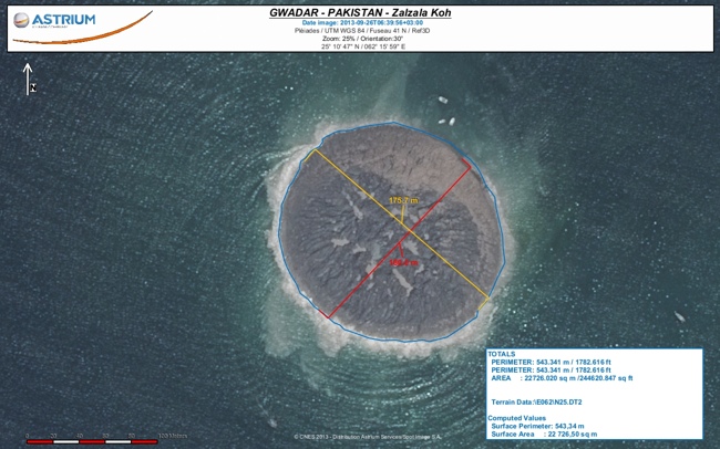
Zalzala Koh Anglais mesure

Leave a Reply

Your email address will not be published. Required fields are marked *