
DataMapWales is a Welsh Government portal that brings together 3,000 datasets, 600 of which are publicly available.
The data ranges from building information to speed limits to the location of public toilets, and lots more.
One of its prime functions is to provide near real-time emergency services information in times of natural disasters, such as floods and landslides.
Data provided by the Ordnance Survey is critical to operation of the portal, with 35 Survey datasets currently available, such as those for topography and street addresses, with others soon to be added.
“DataMapWales is constantly evolving. Looking after a smaller country, we are able to work in a very agile way in terms of what we are delivering and how the portal is used,” said Dave Roberts, Head of Geography, Welsh Government.
Help where it’s needed
Other data available on DataMapWales includes information on electrical vehicle charging access, carbon scenario modelling and emissions and storage aspects.
A new application, called Jigso, is being developed to support Wales’ resilience community, with most emergency services, resilience bodies and first responder agencies already signed up.
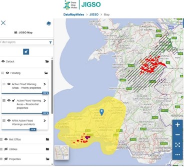
The team developing Jigso is hoping that utility companies will share their data to provide further insight into who in the community might be the most vulnerable during times of emergency.
The use of Unique Property Reference Numbers enables Jigso to link crucial data to specific properties, in order to assist emergency agencies to identify and support those who are most in need of help.
DataMapWales brings together 3,000 datasets – Spatial Source
