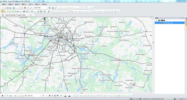
Many cartographers are often anxious about creating a map that is not attractive enough. In the latest updated version of SuperGIS Desktop 3.3 and 10, Supergeo will support users to add more free online maps and make your map more gorgeous.
If you are a professional cartographer who frequently uses GIS software, then you might have the following experience: after conducting spatial analysis and editing data, you would like to add more information to the map for making a visual balance. But you don’t have any other spatial data available, so you can only adjust the color and opacity to improve but get a limited enhancement. Supergeo understands your concern. Therefore, Supergeo has supported Online Map Tool since SuperGIS Desktop 3.3. By using that tool, users can integrate free online maps to SuperGIS Desktop, such as OpenStreetMap (OSM). And in the upcoming version of SuperGIS Desktop, users can integrate more online maps and make your map design more stylish with ease, including topographic maps, satellite imagery, and traffic maps.
With these abundant and ready-to-use map resources, you can create maps with rich features and don’t have to worry that your map design is not attractive enough anymore.
Try Online Map Tool and redesign your map with SuperGIS Desktop 10 now:
http://www.supergeotek.com/download_6_desktop.aspx
Learn more features of SuperGIS Desktop:
http://www.supergeotek.com/ProductPage_SG3.aspx