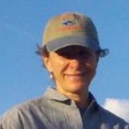
 Jennifer Sheldon is an ecologist, writer, and program manager specializing in terrestrial ecology and wild dog ecology. Her research emphasis includes development of spatial models of carnivore competitive interactions, as well as the demography of coyotes during gray wolf restoration in Yellowstone National Park. Her expertise includes working with multi-disciplinary and stakeholder teams on research efforts. She is the co-founder of Yellowstone Ecological Research Center, and was vice-president for 16 years. She is currently taking a sabbatical year in Victoria, British Columbia working on a book about ecological systems, the human dimension, and resilience. Jennifer spoke at the 2013 Geodesign Summit which Esri recently hosted in Redlands, California. This interview was conducted by Shannon McElvaney after the event, with impressions of the event and about the future of geodesign.
 Jennifer Sheldon is an ecologist, writer, and program manager specializing in terrestrial ecology and wild dog ecology. Her research emphasis includes development of spatial models of carnivore competitive interactions, as well as the demography of coyotes during gray wolf restoration in Yellowstone National Park. Her expertise includes working with multi-disciplinary and stakeholder teams on research efforts. She is the co-founder of Yellowstone Ecological Research Center, and was vice-president for 16 years. She is currently taking a sabbatical year in Victoria, British Columbia working on a book about ecological systems, the human dimension, and resilience. Jennifer spoke at the 2013 Geodesign Summit which Esri recently hosted in Redlands, California. This interview was conducted by Shannon McElvaney after the event, with impressions of the event and about the future of geodesign.
McElvaney: This was the fourth Geodesign Summit Esri has hosted, but the first you’ve attended. What did you think?
Sheldon: The gathered group was unusually varied and included academics, industry leaders, urban planners, students, geographers, educators, and analysts. Carl Steinitz provided the unifying theme with his elegant articulation of the theory of geodesign.
Concepts flew, turned on a dime, and looped back into applications. Talks were met with rowdy applause then contemplative silence. We ate lunch in the midst of a barrage of creative interchanges—young students talked a mile-a-minute with industry leaders, National Park Service landscape architects, and city planners, all exchanging ideas in a congenial atmosphere. Themes included water, resources, restoration, urban landscapes, and the human element. The mix of GIS platform advances with applications and theory was catalytic and provided serious brain-food for all attendees, moving everyone out of their comfort zones and into dynamic interactions during breaks and over meals.
Throughout, the theme of the Geodesign Summit was the open exchange of ideas. Dynamic presentations alternated with close-focus workshops. And threading through this free-wheeling and good-natured summit, the common language was empowered by advances in software, visualization technologies, and processing capabilities. Jack Dangermond’s ready engagement provided a unifying good humor.
McElvaney: What at the Summit really made you think?
Sheldon: In today’s highly technical and specialized world, solutions come from teams. Collegial, thoughtfully assembled groups of experts and non-experts working across disciplines can translate the complex technical requirements of today’s design and planning challenges into reality-based solutions. We saw the best of this fusion and teaming begin to coalesce at the 2013 Geodesign Summit. It’s the free interchange of thoughts and plans that gives the future its legs. The best of creative problem-solving happens with committed teams of creative, solutions-oriented people. The Geodesign Summit’s setting and agenda provided a framework for a success. Maps provide the common language.
McElvaney: This year, we intentionally brought in biologists to mix with urban and regional planning and design professionals to cross pollinate. Did it work?
Sheldon: Ecologists provide insight into the physical mechanisms underlying good design choices (examples: hydrological models let us know about impermeable surface and greenspace planning for cityscapes; Ground truthing provides feedback on CityEngine flythroughs; Biodiversity assessments provide feedback on whether land set-asides are working effectively). In today’s specialized world, talking with people from different disciplines is critical for solutions-oriented activities. Ecologists tend to be academic or management-oriented. It’s good to build conversations with both of these approaches. From my perspective it was fruitful and productive. I learned a lot more about how urban planners approach their constraint space. More cross-discipline feedback from ecologists will be productive here.
One future activity might be to have a round-table to focus more tightly on solutions (e.g. integration of an eco-constraints layer into urban planning efforts). Begin with a real-world problem presentation, then focus a panel discussion on expertise from different fields and how the solution can be parameterized (and supported by software). Be specific about the software architecture needed. For example, how do we address unmet needs in ecological constraint layers in the built environment?

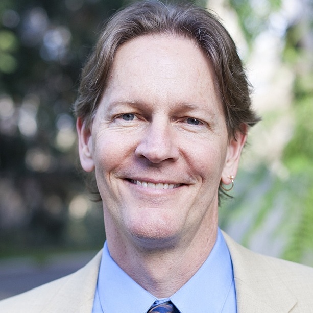
The Yellowstone Ecological Research Center has pioneered work by examining whole landscapes for extended timeframes, and by collaborating in multi-disciplinary teams. Photo by Hamilton Greenwood.
McElvaney: What do you think is needed to bring about the geodesign tools we will need for holistic planning?
Sheldon: We need a three-way interface of:
Integration of these three entities is the research and applications frontier for impacts assessments. The biggest unmet need in impacts assessments is a standardized set of utilities across these three domains. Typically each project comes up with its own unique and unstandardized solution for data integration. While we wait for the incentive system in real world situations to be adjusted, we can still provide the utilities to make impacts more realistic and accountable. EAGLES was a first cut of articulating the unmet needs of practitioners in this three-way integration. Ecology is ready for the next generation.
McElvaney: What did you think of Bran Ferren’s call for a “Bill of Rights for the planet”?
Sheldon: All world-changing movements begin with a timely, self-evident idea carried by people who are bold enough to move it forward.
What we are really mulling over is ‘Where do human interests and ecosystem interests intersect?’ With Sandy, ocean issues, species declines, water quality, we intuitively understand that there isn’t an ‘us (humans)’ vs. ‘them (ecosystems)’ frame any more. We are all supported within an integrated system of air, water, vegetation, ocean, and climate. This unified envelope can be mapped, measured, and supported through excellence in integrated design. Forecast models can yield a visualization of future outcomes for discussion and rational planning. One way to make it more tractable is to borrow from the legal disciplines and move toward the concept of ‘standing’ for systems and their components.
Obama’s Climate initiative provides a first lever. The link between human health and ecosystem health provides a second lever. The costs of continued impacts of current practices provide the third argument: food security (soils and agricultural productivity); energy issues; urban integrity; water issues all combine to make powerful economic arguments for eco-integrity.
As we move beyond simple arguments based on philosophy into a clear understanding of the linkages between ecosystem integrity and human well-being, a new evidence-based thought system will be essential. Spatial data represented clearly and accurately plays the keystone role.

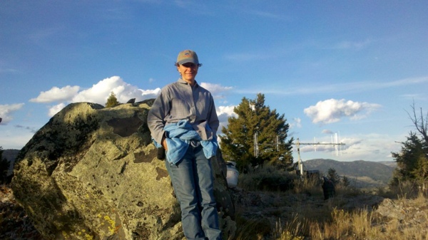
Possible geodesign Hippocratic oath? Above all, do no harm. Photo courtesy of Jennifer Sheldon
McElvaney: One of the things that always comes up is the definition of geodesign, and we frequently go through a number of different definitions provided by various thought leaders. In simple terms, how would you explain the concept of geodesign?
Sheldon: The world of tomorrow is written in the (geo)designs of today.
 Shannon McElvaney is the sustainable development industry manager at Esri and a geodesign evangelist working on developing geodesign tools, techniques, and processes that will enable people to design, build, and maintain livable, sustainable, healthy communities. He has more than 18 years of experience applying a broad range of geospatial technologies across a variety of industries. E-mail: SMcElvaney at esri.com