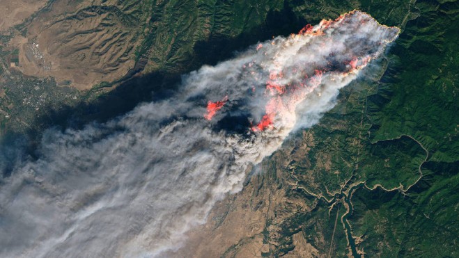
 For the past two weeks, NASA scientists and satellite data analysts have been working every day producing maps and damage assessments that can be used by disaster managers battling the Woolsey Fire near Los Angeles and the Camp Fire in Northern California. The agency-wide effort also deployed a research aircraft over the Woolsey Fire on Nov. 15, 2018, to identify burned areas at risk of mudslides in advance of winter rains expected in the area.
Spearheaded by NASA’s Disasters Program in the Earth Science Division, the team produces a variety of data products largely derived from satellite observations, including maps showing the locations of active fires, damage caused by fires, and burned areas that are susceptible to landslides and mudslides.
These products are distributed to agencies working on the ground in California, including the state National Guard, Department of Forestry and Fire Protection (Cal Fire), the Governor’s Office of Emergency Services, the California Earthquake Clearinghouse and the Federal Emergency Management Agency (FEMA).


