A GIS-user looks for information that makes it possible for him to solve an actual task. If the GIS-user feels that the information allows correct, safe and fast task-solving, then the producer has gained the user’s favour. Then the good question will be, what the GIS-producer needs to be capable of for the purpose of ‘being good in GIS’, so that the GIS actually delivers that information that allows the user to solve his task?
Beside a number of technical skills humbleness is needed when approaching the end-user’s skills and tasks. It is the producer’s duty to explore the user’s skills and the user’s tasks and to include this as a main factor in the GIS-project. In that way GIS is a means of communication that generates efficient contact between the GIS-expert and the end-user’s task.
Introduction
The article’s title claims that GIS is a means of communication. What should this statement be good for? Why not just place the two, GIS and communication, side by side and say that GIS and communication can coexist and at convenient occasions assist each other? Because we can gain something better by redefining their relation. It is wiser to present GIS and communication as two co-ordinated things. The clever thing by coexistence is a remarkable synergy, i.e. much greater effect than what is possible when having the two concepts (and domains) separated. Therefore it is important to discuss the above questions i.e. the relation between GIS and communication; it is possible to create something bigger and better!
{sidebar id=275 align=right} Of course it clearly depends on the definitions of the concepts. And maybe it is actually not so bad starting a discussion here. What is ‘GIS’, and what is ‘communication’? Most GIS-people and communication-people will probably have an opinion on what the two concepts mean each of them, so isn’t that satisfactory and sufficient? Yes, it might be enough. But, on the other hand it might be sound for the domains to take that discussion at regular intervals.
It has something to do with expectations and with certainty in the information exchange between people. If for example a group in an organisation gets the permission to look for and employ a new colleague with the condition that this new colleague must be ‘good at GIS’, what does this actually mean? What types of skills is this new colleague supposed to have? What does the employer actually expect? What is it actually that the promise to the boss includes, when a group promises to find a new colleague who is ‘good at GIS’? Not to speak of who can and should apply for the job, i.e. who has the right skills that comes up to the employer’s expectations?
That is just one example. There are more examples that make it necessary to discuss the connection between ‘GIS’ and ‘communication’. How should one explain to a minister or to a municipality politician, who both have approximately 20 seconds attention left, what the beauty is by GIS (to answer the question why they should put more money into the GIS-domain)? It won’t make much sense to start explaining that GIS makes it possible to make nice overlay-analysis across different databases in different institutions (or similar example).
An airplane is a means of transportation that can move people over long distances in a short time frame. A particular mixture of chemicals is a means of the combating of disease that e.g. fights and suppresses malaria. Similarly: What is GIS?
GIS is a means of communication
GIS is a means of communication. If this short sentence makes it possible to catch attention of e.g. a politician, then it is achievable to extend the description to e.g. GIS is a means of communication that makes is possible to transmit extremely complex information in a way so that everybody can keep up (benefit) – assumed it is made properly.
GIS can transmit complex information in a way so that neither text, neither ‘spreadsheets and tables’ nor speak can keep up with it with regards to comprehensibility! Then we are almost where we want to be! In particular if this short explanation is followed (assisted) by a good example. And shortened by a skilled journalist who knows how to express complex sentences consisting of 57 words (like the above) in a short readable statement.
Communication – reaching agreement and decision making
Communication is a trite concept that is being used and abused in many relations. There isn’t actually any broadly accepted, general definition of the concept. However, communication can be defined like this, having an eye to GIS: reaching agreement on relevant aspects in a given case with the help of exchanging information.
{sidebar id=276} A definition like this could actually assist the above discussion about the relation between GIS and communication. In this case GIS is a means of information-exchange, and communication assures that the information proves useful. In this connection prove useful and agreement is the same.
One example is travel planning (as GIS-web-service). A travel planning web-service serves as a means of information exchange between a traveller (the user) and the consortium of transport companies, and between a numbers of sub-contractors (databases).
The exchanged information proves useful when the user (the traveller) reaches agreement with the producer (the transport consortium and the transport companies) about a suitable and useful travel-plan that fits the user’s particular demands regarding different conditions (time, price, comfort etc.). Opposite to this, if the parties do not reach an agreement that allows the user to decide whether to start the travel or not, then it all doesn’t really make sense – despite excellent algorithms, fast databases, clever standards for web-feature services etc.
Correspondingly, politicians must be supplied with information that puts them in a position where they can decide (this is what we have the politicians for), e.g. make decisions on rules for organic fertilizer distribution. To be able to make sound decisions the politician needs the right information that fits the politician’s questions and considerations.
To get to this point where the right information is available for the politician, it is necessary that the GIS-expert and the politician exchange another sort of information, which is information about what types of information can satisfy the politician’s questions and considerations. When they agree on this, what is needed, then they have reached the necessary agreement.
The two parties have to agree to what the relevant information may be; the livestock’s addresses, trade of organic fertilizer, soil conditions, climate conditions, etc. When the GIS-expert transmits the answers to the politician’s questions then they have agreed to what is the right information.
The sentence ‘information that allows decision making’ is the core of the communication concept. Every communication is about gathering information that allows decision making. Every communication! ‘Did you remember to buy beer, darling?’ ’Yes!’ Good, then I don’t have to get up from the sofa. Maps and geoinformation about e.g. real estate rights etc. allow decision making whether one dares to invest a huge amount of money in a particular real estate (house). Soldiers at work exchange information, with the help of GIS, maps and geoinformation, which allows decision making regarding deployment, shooting, etc.
Communication – the involved parties’ roles
The involved producer-experts need to behave extremely humble towards the end-user to have a chance to succeed with this exchange of ’information that allows decision making’. The producer-expert must put him self in the position of the end-user to be able to help the end-user with decision making. The producer-expert must make himself acquainted with the end-user’s skills and tasks. And then, from this point it is possible to work something out.
This is the secret of all help, as the great philosopher Søren Kierkegaard wrote. To be able to help an end-user the producer must be more knowledgeable, of course, but foremost understand what the end-user knows and has to do. If the producer does not have his point of departure in the end-user’s skills and tasks then the producer’s expertise is of no assistance, and then it is perhaps more a question of vanity, pride and a need for being admired that are the driving forces.
True help starts with a humiliation; the producer must humiliate him self under the person he wants to help, and hereby understand that offering help is about being wrong at the beginning and to understand what the end-user understands (adopted from Søren Kierkegaard).
{sidebar id=277 align=right} If the humble behaviour is given top priority it is difficult to maintain e.g. the concept of general and neutral databases (that are expected to cover more or even many domains) and also the concept of general and neutral data-standards etc. The humbleness embeds consciousness and respect for each project’s particularity.
On consequence of this is that each single GIS-project at the beginning must start all over defining project identity, domain model (content), system/apparatus, interaction, expression and distribution. In a practical and reel everyday it will of course be limited how many different particular projects that can be can be made allowances for. Of course there are practical constraints in practical everyday life. On the other hand, some times we should discuss principles and ideals without considering these constraints (as they will appear anyway by them selves).
GIS as concept
The concept GIS is an even more trite concept than the concept of communication, if possible at all. One could easily say that the concept GIS has been flogged to death. But, we have the concept and we use it, and therefore we have to start the discussion here.
It might not be quite wrong to say that a common understanding of ‘being good at GIS’ is that one must be able to: (a) being in control of particular software (e.g. ArcGIS or Mapinfo – in rough terms), (b) building algorithms, (c) being in control of datalogy, as well as (d) having deep insight in certain databases. I think this understanding of the concept is too narrow, because it leaves out relations to the surroundings. And that is not good enough!
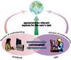
There is nobody who works isolated from the rest of the world. At least there is a boss who pays the GIS-expert’s salary, and this boss wants to see results in form of happy customers (cf. figure 2). It is not difficult to imagine how wrong it can go (miscalculations and misconceptions) if there is less than close contact between the GIS-producer and the end-user.
Nevertheless, eminent books like Østergård and Dørup Olesens ‘Digital forkalkning’ and Lauesens ‘User Interfaces’ point very clearly out that there very often is a pronounced lack of contact und lack of humbleness (cf. above) between GIS-producer-experts and the end-users. This pronounced lack of close contact has lead to many ‘capsized’ IT- and GIS-projects; the list is long and does not need any further explanation in details here, we all know plenty of examples.
Therefore we must extend our common understanding of the concept of GIS, with the aim of bridging the gap between GIS and communication – for the purpose of getting more satisfied end-users (and confident politicians, so that they can send us more money).
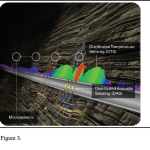
‘Body of Knowledge’ (University Consortium for Geographic Information Science, UCGIS), which is an educational programme, describes the necessary skills with a GIS-expert (figure 3).
This is suddenly something else than the above mentioned four skills (software, algorithms, datalogy, and databases). ‘Body of Knowledge’ includes still the technical elements, but includes also (e.g.) organisation, project management, visualisation, jurisprudence, and ethics. The GIS concept in ‘Body of Knowledge’ is still a bit introverted and lacks a direct relation to the end-user.
{sidebar id=278} Discussing the GIS-concept it can be useful to place the point of departure in as coordination of GSDI (geo-spatial data infrastructure) and the humanities. Through this it becomes possible to describe GIS-and-the-transmission-of-information as (source: ‘Geo-communication and information design’ by Brodersen, 2008): (1) a research basis consisting of theory formation and thesauri, (2) on top of that the traditional GIS-subjects (data, information, hardware, methods, and software – with human beings added), and finally (3) project aspects, which actually is the overall, crucial factor.
Figure 4 deals in opposition to figure 3 with those elements in play when a GIS-project is up and running. These are the elements a GIS-project-manager must manage and be in control of! Figure 3 (Body of Knowledge) is in opposition to this an educational programme.
Communications-GIS, synergy
It might be worth considering introducing a new concept ‘Communication-GIS’. Communication-GIS is GIS in common sense with the additional aspect that the superior scope is to ensure the end-user the best possible basis for decision making. The reason for existence for communication-GIS is that an end-user can solve his tasks correct, safe and fast.
Communication-GIS utilize all the skills mentioned in ‘Body of Knowledge’ (figure 3) plus a considerable end-user focus. The synergy in communication-GIS is that the right information is worked up with focus on the end-user’s task-solving.
In communication-GIS data can be twisted, turned, rotated, moved, and distributed through efficient channels and be served the end-user, so that the task-solving can carried out correct, safe and fast. In a world with efficient and appealing communication-GIS the end-user will consciously or unconsciously grab GIS-products with the confident feeling ‘here I will get proper information that allows me to solve my task correct, safe and fast.’
The opposite of communication-GIS is to define the aim of any GIS-project as ‘data being at disposal’ and the end-user is left to extract the information by him self. Jesper Koch, National Survey and Cadastre Denmark showed at Geoforum Denmark’s Map Days 2008 (Koch, 2008) plenty examples of what this leads to, which is unhappy and unsatisfied end-users (costumers). It can under certain circumstances be justified that ‘data’ are the aim of a GIS-project. But that should only happen within a closed/narrow circle of experts with comparable skills and tasks.
As soon as a GIS-project appeals to common target groups respectively domains with diffuse limitations, common communication theory calls for at reduction of the quantity of information, and calls for at strong focus on the expected, practical task-solving processes at the end-user’s end. The respect for the end-user’s skills and tasks must be enthroned when working with GIS-projects: project identity, content, system/apparatus, interaction, expression, and distribution.
References:
Brodersen, Lars. “Geo-communication and information design”. Publisher: Tankegang, 2008. ISBN 978-87-984-1135-2. www.geokommunikation.dk
Koch, Jesper. Miljøportalen og Mondrian – når præsten taler latin”, Danish Geoforum’s Map Days 2008. www.geoforum.dk/Default.aspx?ID=7766
Lauesen, Søren. ”User Interface Design : A Software Engineering Perspective.” Pearson Education Limited, 2005. ISBN 0-321-18143-3
UCGIS. “Body of Knowledge.” www.ucgis.org/priorities/education/modelcurriculaproject.asp
Østergaard, Morten; Dørup Olesen, Jeppe. ”Digital forkalkning” Dafolo Forlag, 2004. ISBN 87-7281-144-7