Future climate inconsistencies will demand more widespread planning. Major global catastrophes such as Hurricane Katrina’s rampage over New Orleans or the massive earthquake in Pakistan in 2005 demonstrate significant truths about our vulnerability and the power of nature. However, sometimes it is the slightly less dramatic – second division disasters, if that’s not too insensitive a description – that teach us lessons on a more practical level.
Often, the effects of these, more local events, could have been reduced by better planning and improved readiness – a fact that can make any tragedy that ensues all the more poignant.
Take this summer’s flooding in parts of the UK. This was described as being “on a biblical scale” by one UK national newspaper, but from an international standpoint, it was a relatively contained.
Yet human error – and, therefore, human misfortune – was rife. For example, the flood barriers failed to arrive on time because they were stored half an hour’s drive away and, ironically, the operatives were held up on the motorway by the very flooding they were travelling to help prevent.
If predictions concerning climate change are correct, flooding on this scale will become an increasingly commonplace phenomenon. Not only will local authorities and other interested parties need to be able to actually respond quicker and more effectively to emergencies, they will also need to be able to show that they can do so with the right information and plans at their fingertips.
But, whereas cataclysmic events can justify complex and costly, centralised warning and planning software, more frequent disasters such as flooding in areas known to be low-lying and susceptible, call out for a lighter solution.
This needs to be user-friendly, capable of combining CAD and GIS seamlessly and be affordable enough to be installed on desktops throughout local authorities or government offices. Ideally, it would also enable users to broaden access to essential geographic data via the internet or an intranet so that it is accessible round-the-clock to all interested parties such as the police, fire service and schools.
Building blocks
Autodesk has always seen its role as the democratisation of CAD, refining high-end and complex technology to make it usable – and useful – for the mainstream market. This, alongside its ability to integrate CAD and GIS in the system as part of solutions such as AutoCAD Map 3D, makes it an ideal contender for this role.
Of course, its infrastructure software provides no flood warning solution per se. However, it does offer easily available AutoCAD-based building blocks that can used by a third-party developer to create a tailored application. And even without any add-on applications it can provide an excellent way of storing information with a map-based interface to centralise and integrate diverse geospatial data.
The UK company United Utilities (UU) is currently undertaking the most extensive investment programme in the country’s utility sector, spending nearly £2 million a day on improving its environmental, water, wastewater and electricity networks and customer service.
Its entire lifecycle of both water and electricity assets is managed by geospatial solutions from Autodesk, based on a central Oracle database. UU also employs Autodesk Consulting to define, develop and deploy the solution and give support to the ongoing project.
Because the systems are based on open technology, data can be easily accessed, interrogated and analysed. It can also be moved seamlessly into any further application, enabling the team to choose whichever software is best for the job.
The UU system also provides a hybrid GIS and CAD environment. As a result, data can be created and maintained in high-precision CAD, providing the ability to include accurate measurements and scale. In fact the two environments are integrated so seamlessly, that users don’t see the geographic and engineering information as two separate entities.
Nearly 400 users throughout the company have fast, easy access to current, high quality and accurate data via the Autodesk MapGuide GIS browser.
Because workflows lead operators through the correct processes and ensure standards are followed, this data is good quality and highly-accurate and can be used for a wide variety of purposes. For example, UU can identify risk areas and so prioritise budget. For example, using a 3D CAD model combined with rainfall data and OS MasterMap information on ground types, it can calculate how quickly rain will seep through the ground and calculate the risk areas for flooding on the sewage network.
Emergency planning
It’s easy to see how this way of integrating and collating data could be translated by local government offices and agencies to give stakeholders access to vital geospatial information.
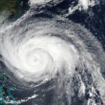
In fact, this is exactly how MapGuide software is being used by the Florida State Emergency Operations Centre (EOC) in the US which provides information to National Guard personnel and county agencies who in turn provide this data to “first responders” or the emergency workers who respond to the scene of man-made or national disasters such as floods or hurricanes. The Tallahassee-based organisation uses the solution as the backbone for various websites that offer flood maps, evacuation routes and shelter locations, as well as homeland security websites used by law enforcement officials.
Using Autodesk software the EOC can share information about flood zones, emergency shelters and other disaster services with many other local and state organisations, as well as the public. Staff can also see the relationship of important sites such as hospitals, schools and fire departments to one another and to the road network and can add map layers with contact information for these various sites.
With MapGuide, EOC workers and other emergency support staff can provide location information to first responders before they even arrive at the scene. “We can also collect information from the first individuals on the scene, add it to our mapping data and make it available to additional emergency workers prior to their arrival,” said Gary Watry, GIS co-ordinator.
The EOC plans to integrate hurricane forecast information from national weather services into Autodesk MapGuide-created maps, allowing staff to conduct predictive modelling and estimate impact. Traffic counters can also be integrated into the system, allowing emergency workers to estimate how many people are left in an affected area and need to be evacuated. The long-range goal is to allow citizens in Florida to go to the website, type in their zip code and access all the warnings, watches and other information necessary for their safety.
Lessons to learn
With the prospect of a growing number of unexpected natural events on the horizon, it seems other agencies could learn from Florida EOC’s experience. And the best thing about a solution such as theirs is that it is based on technology which can be already found in many local government offices worldwide.
Having accurate and reliable data, which is easily accessible, round-the-clock by all those who need it, can go a long way to help preparations for unexpected events. Hopefully it won’t be needed too often – but when and if it does, everybody will be ready.
Dominic Jukes is employed at Autodesk in Europe.