Tuesday, February 5th, 2013
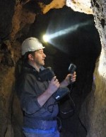
3D Laser Mapping has announced the latest in a series of free, application specific workshops designed to promote a new range of innovative, hand-held 3D laser scanners. Aimed at potential users of the Mantis Vision imager from within the Archaeological and Heritage sectors, the workshop will take place on the 14 March, 2013 at the
Thursday, August 9th, 2012
Based on the recommendation of SuperGeo’s distributor, Spatial Perspective, in South Africa, Geospatial Resources, the consulting company that serves Environmental Services, Town Planning, and Surveying, purchased SuperGIS software to assist the local governments in dealing with environmental problems resulted from mining and implementing the policies of field conservation.