Disasters and emergencies can happen at any time, often without warning. Natural hazards threaten thousands of lives and cause billions of dollars in damage every year throughout the nation.
September is National Preparedness Month, a time to highlight the resources available to help you and your loved ones stay as safe as possible. This article features several science tools that are important for preparing for such events and helping guide decisions to minimize impacts.
Explore Your Hazards
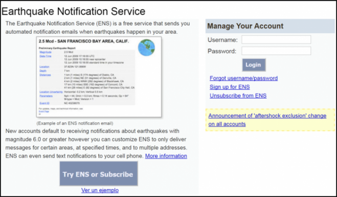
Sign Up for Alerts
Help Scientists

USGS: Start with Science
You can’t plan effectively if you don’t know what you are planning for.
By understanding how the Earth behaves and identifying potential hazard scenarios, meaningful risk analyses can be performed. This includes making informed decisions on insurance rates; emergency preparedness plans; building and land-use codes; improving private property for increased resiliency; investments in infrastructure, such as dams and reservoirs; and more.
The USGS works with many partners to monitor, assess and conduct research on a wide range of natural hazards. USGS science provides policymakers, emergency managers and the public the understanding needed to enhance family and community safety.
Below are a few ways USGS science is helping keep America safe.
Volcanoes
The United States is home to 169 active volcanoes across numerous Western states and territories. The USGS operates five Volcano Observatories as part of the USGS National Volcano Early Warning System. By analyzing data from its monitoring networks, the USGS issues public warnings and alerts about conditions at U.S. volcanoes, and this includes models for ashfall forecasts and aviation notices.
Landslides
Landslides occur in all 50 states, and every year cause loss of life and billions of dollars in damage to public and private property. USGS science is helping assess where, when and how often landslides occur and how fast and far they might move. In southern California, the USGS partners with the National Oceanic and Atmospheric Association’s (NOAA) National Weather Service (NWS) to provide important advance warnings for debris-flows generated in areas burned by wildfire.

Hurricanes
Before, during and after major hurricanes or tropical storms affecting the United States, the USGS assesses the likelihood of and issues forecasts on beach erosion, overwash or inundation. The USGS also measures storm surge and monitors water levels of inland rivers and streams.
Wildfire
The USGS provides tools and information before, during and after fire disasters to identify wildfire risks and reduce subsequent hazards. This includes delivery to fire managers of up-to-the minute maps and satellite imagery about current wildfire extent and behavior.
Human and Wildlife Health
USGS scientists are working with partners to monitor, investigate and develop control options for numerous wildlife and human diseases. Research efforts include zika virus, bat white-nose syndrome, avian influenza, sylvatic plague, Newcastle disease virus, chronic wasting disease and West Nile virus. Another hazard impacting safety and human and ecosystem health are dust storms, especially in the Southwest. The USGS and land managers are working together to better understand the causes and sources of dust storm activity.

Drought and Floods
The USGS operates a nationwide streamgage network to monitor water level and flow in rivers and streams. The USGS also works with many partners to provide essential data for flood forecasts, watches and warnings. USGS science contributes to the U.S. Drought Monitor as well as the Drought Outlook led by NOAA’s NWS. On a global scale, the Famine Early Warning Systems Network identifies populations with the most food insecurity. This network is an activity of the U.S. Agency for International Development, with the USGS serving as an implementing partner.
Tsunamis
The USGS studies recent and historic tsunamis to better understand impacts, processes and causes, with a focus on investigating earthquakes as triggers. Scientists have evaluated the number of people or businesses exposed to tsunami hazards, as well as demographics and evacuation time for each of these communities. This provides officials with the ability to develop outreach, preparedness and evacuation plans that are tailored to local conditions and needs.

Geomagnetic Storms
The dynamic interaction between the solar wind and the Earth’s magnetic field causes geomagnetic storms. The resulting rapid magnetic field fluctuations can interfere with radio communications, GPS systems, satellites, electric power grids and directional drilling for oil and gas. The USGS operates a network of specially designed observatories that provide real-time data on magnetic storm conditions. The USGS also maps geoelectric hazards associated with magnetic storms, a product especially important for mitigating hazards to electric power grids.
Earthquakes
Earthquake hazards are a national threat, with nearly half of Americans exposed to potentially damaging earthquakes. The USGS has created and provides information and tools to support earthquake loss reduction for the country. The USGS and its partners are also building a prototype Earthquake Early Warning System for the West Coast of the U.S. called ShakeAlert. The system could provide vital seconds to minutes of warning before the arrival of strong shaking.
America’s PrepareAthon! on September 30
Get prepared and join millions of people participating in America’s PrepareAthon! This is a campaign encouraging people across the nation to practice preparedness actions before a disaster or emergency strikes. Activities include drills, group discussions, exercises and more.
The Great ShakeOut on October 20
Millions of people across the nation will be participating in the next ShakeOut earthquake preparedness drill, to be held on Oct. 20, 2016. At 10:20 a.m. local time, participants will “drop, cover and hold on.” Mark your calendar and sign up to join.


