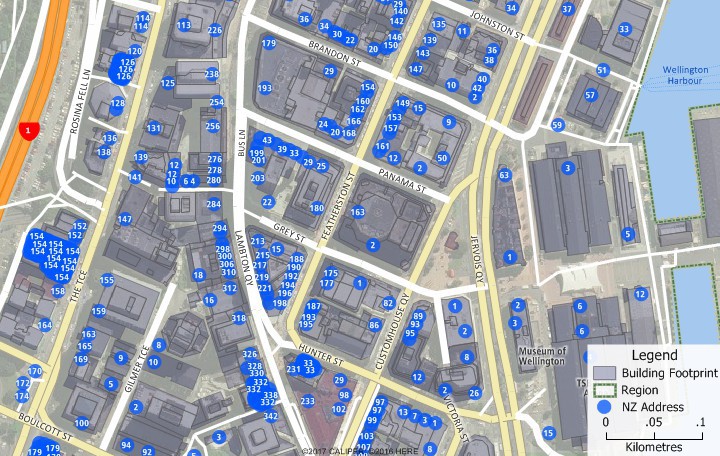
NEWTON MA (USA) – Address data in New Zealand continues to boost the economy because of shrewd moves by the New Zealand government. Initiatives under the Business Growth Agenda and the Open Government Partnership are making public data more available for the benefit of everyone in New Zealand. With precedent in only a few countries such as Denmark and Australia, these “open data” initiatives provide significant boosts to the host economy. By integrating the now freely available Address Information Management System (AIMS) addresses into Maptitude, the value of the mapping software is even more unassailable and empowers even non-techie users with map aptitude.
You do not have to pay a premium for nationwide address-level geocoding (pin-mapping). With Maptitude 2017 (US$695) and the New Zealand Country Package you can easily work with over 2 million address points to:
When you know where every single address in the country is, the possibilities for geospatial analysis are limitless. When you have direct access to this data for visualization, research, and address matching as you do in Maptitude, then you will be empowered to achieve what would otherwise require a significant investment and a specialized education.
Caliper Corporation develops state-of-the-art Geographic Information Systems (GIS) software. With a focus on usability, Maptitude is designed to be a cost-effective, professional location mapping software product. Maptitude enables organizations to leverage their location-based data to improve decision making and planning, while minimizing expenditure through competitively priced solutions.
Caliper is a privately held corporation and is a leading developer of mapping, redistricting, transportation, and GIS software.