Wednesday, March 6th, 2013
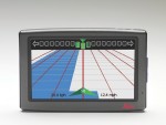
Leica Geosystems announces several new product features and support updates as part of the company’s continued investment in precision agriculture solutions. The company also releases additional steering solutions for several existing and new tractor models for the Leica mojo3D as well as access to the GLONASS constellation for the Leica mojoMINI.
Thursday, February 28th, 2013
The Microsoft UltraCam business unit announces the immediate availability of the 210mm lens for the UltraCam Eagle digital aerial camera system. The UltraCam Eagle was introduced at the ASPRS conference in Milwaukee in May 2011 as the first multi-cone digital photogrammetric camera to offer an exchangeable lens system with 80mm (standard) and 210mm (tele) lenses.
Friday, February 22nd, 2013
Blue Marble Geographics is pleased to announce the release of Global Mapper SDK version 14.1. This release offers many new and improved features and functions including a significant improvement in the ability to process and visualize massive amounts of LiDAR point cloud data, jumping from supporting files that contain tens of millions of points to those
Thursday, February 14th, 2013
The most recent ArcGIS Explorer Desktop release includes new features and enhancements to make it a more powerful tool in an enterprise GIS, including content sharing via ArcGIS Online, tabular information display, and new presentation tools. ArcGIS Explorer Desktop is a free GIS viewer that enables the exploration and visualization of GIS information.
Thursday, February 14th, 2013
Blue Marble Geographics is pleased to announce the release of Global Energy Mapper 14.1 today, making available a variety of enhancements in the most affordable yet powerful GIS tool available for energy professionals. This update to the company’s popular desktop GIS software offers many new and improved features and functions including a significant improvement in
Wednesday, February 13th, 2013
Intergraph announces the release of Geospatial SDI 2013 as part of Intergraph Geospatial Portfolio 2013. An interoperable and scalable spatial data infrastructure for cataloging and delivering enterprise geospatial data over the web, Geospatial SDI 2013 is designed for data providers that need to manage and serve secure or licensed information using standards-based web services.
Thursday, February 7th, 2013
Intergraph announces the release of ERDAS IMAGINE 2013 as part of Intergraph Geospatial Portfolio 2013. Engineered to scale with users’ geospatial data production needs, ERDAS IMAGINE 2013 allows organizations to perform advanced remote sensing analysis and spatial modeling. With ERDAS IMAGINE, users can create new information by visualizing results in 2D, 3D, movies, and on cartographic-quality
Tuesday, February 5th, 2013
PCI Geomatics, a world leading developer of remote sensing and photogrammetric software and systems, announces it has released its Geomatica 2013 Service Pack 1. This release contains maintenance fixes and includes all updates delivered since Geomatica 2013. The update is available for both Windows and Linux based operating systems.
Thursday, January 31st, 2013
Blue Marble Geographics is pleased to announce the release of Global Mapper version 14.1. This update to the company’s popular desktop GIS translation software offers many new and improved features and functions including a significant improvement in the ability to process massive amounts of LiDAR point cloud data, jumping from tens of millions of points to
Wednesday, January 30th, 2013
Bentley Systems, Incorporated announced the immediate availability of the Bentley Pointools V8i application and two new iWare apps: Bentley Pointools View for point-cloud data visualization and sharing and Bentley Pointools PODcreator for converting laser scans to the POD file format. These offerings provide powerful, intuitive, and seamless preprocessing of point clouds for distribution, facilitating information mobility across the
