Monday, February 21st, 2011
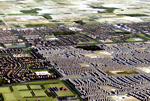
Cicada Design Inc. recently won a 3D Award for Territory Management at the imagina conference in Monaco in the Urbanism and Landscape section. Their work for the Mount Pleasant Secondary Plan located near Toronto, Canada included restoration of a natural heritage system for the area including woodlands, wetlands, watercourses and valleys. This effort included a high
Saturday, February 5th, 2011
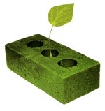
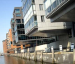
Over the past decade, green building has gone from the fringe to the mainstream of the building industry. In many communities, buildings have “gone green” by adopting strategies such as integrative design, energy modeling, commissioning, enhanced energy efficiency, renewable materials, attention to daylight and views, water conservation measures, and on-site renewable energy generation. Use of
Friday, February 4th, 2011
Geological information is useful for many purposes in the mining industry and environmental monitoring – improvement programs. Technological innovation is now providing 3D and 4D geodata useful for visualisation. GeoVisionary, a visualisation 3D stereographic software produced by the British Geological Survey (BGS) and Virtalis company incorporates spatial data for geological mapping projects.
Monday, January 17th, 2011
We can easily imagine the whole picture, if a particular problem is sketched on a sheet of paper, or when the observed area is illustrated with a painting, in conjunction with understandable symbols. A map is therefore a visual representation of particular portion of space by means of symbolic delineation of properties and relations between
Monday, January 3rd, 2011
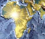
Nikola Tesla (1856-1943), possibly the first scientist who devised a wireless world, looked at Science as a common service, a way to improve the lot of mankind, not just a means for enhancing wealth (less than ever, the wealth of the few), or to bend to compulsions of market economy. Geomatics and Geoinformation can give
Sunday, December 19th, 2010
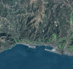
The city of Genoa, Italy, established the Urban Lab in 2007 to create a sustainable development plan for the Mediterranean port city. Designed by 1998 Pritzker Architecture Prize Laureate Renzo Piano, the lab convenes a monthly roundtable called the Table of Ideas to tap the expertise of top design and urban planning professionals from around
Sunday, December 12th, 2010
Information technology has changed significantly since its widespread adoption from the mid-80s onwards. Despite evolving to include online social networking, virtual worlds and gaming, it generally remains a socially isolating experience. With users seek to enter a digital world that removes them from their surrounding reality. However, this is certain to change over the next
Wednesday, November 24th, 2010
The growth of mega-cities around the world poses unique challenges for managing infrastructure, health, communities and transportation. This expansion is near impossible to understand and plan for appropriately without the assistance of spatial information and geospatial technology. Geographic informatiom systems (GIS) and computer-aided design (CAD) are both helping to address these challenges. Yet, other areas
Thursday, November 11th, 2010
To address the challenges of sustainable management and development of the built environment, engineers and facility managers need to exploit the 3D City models which grown in recent years to include interior space. A crucial issue for facilitating interaction with these 3D city models is the ability to integrate 3D BIM into the geospatial context.
Monday, October 11th, 2010
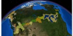
It is a truism that Canada and the United States share the longest undefended border in the world. What is often overlooked in the observation, though, is that much of the border is water. More than 300 lakes and innumerable streams and rivers are part of or cross the international boundary, accounting for 40 percent
