Tuesday, May 8th, 2012
A key component in the global effort to mitigate climate change is to measure and map the amount of carbon stored in forests. This is at the core of the United Nations Collaborative Programme on Reducing Emissions from Deforestation and Forest Degradation in Developing Countries (REDD) and of similar “cap & trade” initiatives in developed

Monday, March 26th, 2012
For the first time Singaporean authorities have given permission for a photogrammetric UAV mapping/modeling flight over an important area of the city. In the context of the SEC-FCL (Future Cities Laboratory) project a pilot study is conducted with the goal to generate a high quality 3D city model of the NUS campus from UAV images.

Monday, March 12th, 2012
In this article we look at the e-mobility initiative BALLADE and show how the success of such efforts will depend on many different Standards Development Organizations (SDOs) working together to “tune” the Smart Grid for efficient communication of location information.

Sunday, January 22nd, 2012
The INSPIRE Directive considers that spatial information is needed for the implementation of Community policies which must integrate environmental protection in accordance with Article 6 of the Treaty, and establishes the basis for an infrastructure for spatial information in Europe in order to support EU environmental policies and those activities which may have an impact
Tuesday, December 20th, 2011
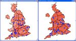
Senior politicians do not always appreciate the value of Geographic Information and Location Intelligence. With their minds now sharply focused on boundary changes for the UK Parliament, nothing brings home the importance of spatial analysis as clearly as the threat of losing some seats. In this article Jamie Justham, Chairman of Dotted Eyes, one of the UK’s

Monday, November 21st, 2011
Founded in 1985, ECTP-CEU (European Council of Spatial Planners-Conseil européen des urbanistes) brings together 25 professional town planning associations and institutes from 23 European countries as well as corresponding members. It is an umbrella association providing its members with a common framework for planning practice, planning education, continuing professional development and the definition of professional

Monday, November 14th, 2011
Supply chains include both upstream and downstream relationships involving goods, services and customers. The delivery of geographic information (GIS) will necessarily include each of these. The Supply-Chain Operation Reference (SCOR) Model can be used to interpret and understand geospatial supply chains. The mapping of the various processes will assist a GIS unit to understand the processes involved
Saturday, October 15th, 2011
Mapumental is a start up of mySociety, the organisation that builds award-winning non-profit websites and carries out commercial work for clients such the BBC, The Guardian, Google, and national and local government. In 2007 the project started develop prototypes for real time maps that could handle huge amounts of travel data. In 2009 it won
Wednesday, September 21st, 2011
Planning and mainly spatial planning deals with the spatial dimension of development. It is concerned not only with architecture but also with the place where people live and work. Spatial planning is one of the major challenges facing Europe. In the future it won’t be possible to solve planning problems of regional development without access to spatial knowledge. Good

Tuesday, August 30th, 2011
Sustainable tourism is an important aspect of many European countries and regions. It plays a crucial role in parks, protected areas and coastal zones. To be able to guarantee tourism activities and development in regions, public servants have to be trained about potential influence of investment in tourism on the environment. Nature protection and support
